
 Independent data released by the Queensland Government has clearly demonstrated the state’s primary producers play a significant role in managing landscapes for ecological health while also fulfilling the vital task of feeding the world.
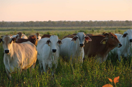
Cattle Australia (CA) Chief Executive Officer, Dr Chris Parker, said the latest Statewide Landcover and Trees Study (SLATS) report shows it is possible to strike the right balance between conservation and agricultural production, and supports the beef industry’s land management practices.
“The narrative that agriculture, and the beef industry in particular, are somehow perpetrating widespread habitat destruction has been discredited, yet again, by this latest data,” Dr Parker said.
“The report shows in 2021-22 there was a decrease of seven per cent in overall woody vegetation clearing activity across the state compared with the previous year.
“This decrease is nothing but a good outcome for biodiversity and carbon emissions reductions in the state.”
Acknowledging the reported increase of regulated vegetation clearing, up from 61,400 hectares in 2020-21 to 71,100ha in 2021-22, Dr Parker said it was imperative the figures aren’t taken out of context as a means to discredit the positive findings.
“The increase is largely due to more landholders managing vegetation encroachment on native grasslands in response to the sequential wet years Queensland has experienced – actions which also support biodiversity and environmental outcomes,” Dr Parker said.
“Additionally, regulated land in Queensland amounts to 140 million hectares, meaning the 71,100ha that was cleared represents just 0.051pc of the total area. Of that 71,100ha, 74.5pc is categorised as land area of least concern.
“Overall, the data shows the trend is down, with a 64pc reduction in regulated vegetation clearing over a four-year period.”
Dr Parker said also contributing to the positive findings was the further 31,097ha of regrowth mapped as part of the study, adding to the 59,654ha of new growth mapped the previous year.
“The SLATS is an important tool that enables the monitoring of how much land is being cleared and ongoing vegetation clearing trends in Queensland, and it is pleasing to see consistent updates to the mapped area,” Dr Parker said.
“Ensuring this data is up to date and accurate enables the state’s primary producers to scientifically verify claims tied to environmental, social and governance requirements, and we look forward to working with both the Queensland and Federal governments to ensure the continuation of this progress.
“Doing so will further support initiatives such as the Land Management Commitment in demonstrating how we manage landscapes in the unique Australian context.”
Dr Parker said the latest data highlights the importance of a vegetation management framework that protects native ecosystems while also allowing landholders to manage their properties to ensure they can continue growing the food and fibre that is fundamental to the prosperity of our communities, industry and country.
“It’s also a showcase of how the agriculture industry, stakeholders, legislators and community can work collaboratively and engage in sensible and respectful discussions to achieve greater outcomes for the landscapes, animals, biodiversity, food security and communities throughout Australia and across the globe.”
-Cattle Australia